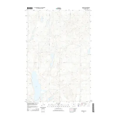
2014 Map of Wishek NE
USGS Topo · Published 2014About this map
Beaver Lake and its surrounding wetlands define this portion of Logan County, where the prairie landscape is punctuated by numerous glacial potholes and depressions. In the early 21st century, this area remains a mosaic of water and land, with Island Lake and Doyles Lake anchoring the southern portion of the quadrangle. The drainage of Beaver Cr weaves through the southwest, while a precise grid of county roads, including 41st Ave SE and 68th St SE, segments the territory into its constituent sections. These thoroughfares, such as Cr-2416, provide the primary access through this agricultural and hydrological complex, reflecting a landscape that has changed little in its fundamental spatial organization since the initial land surveys.
Find a feature on this map
14 named features on this map. Tap any name to fly to it.
Don’t see what you’re looking for? This feature index may not catch every label — zoom into the map to look around manually.
Map Details
Editions of this 2014 Wishek NE Map
This is the sole edition of this map. No revisions or reprints were ever made.
Other maps of this area

1953 · Jamestown
USGS Topo · 1:250,000

1956 · Jamestown
USGS Topo · 1:250,000

1982 · Wishek SW
USGS Topo · 1:24,000

1982 · Wishek NE
USGS Topo · 1:24,000

1982 · Burnstad
USGS Topo · 1:24,000

1982 · Lehr NW
USGS Topo · 1:24,000

1982 · Lehr SW
USGS Topo · 1:24,000

1982 · Wishek
USGS Topo · 1:24,000

1983 · Streeter SW
USGS Topo · 1:24,000

1983 · Alkaline Lake SW
USGS Topo · 1:24,000