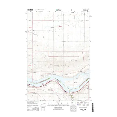
2014 Map of Wishram
USGS Topo · Published 2014About this map
Wishram and the historic riverfront of the Columbia River anchor this 2014 survey, highlighting the complex intersection of transport and geography on the border of Washington and Oregon. The map detail follows the river's path through Hells Gate, where the waters of Lake Celilo separate Klickitat County from Wasco and Sherman Counties. The settlement pattern reveals the importance of the rail and road network, featuring Oregon Trunk Junction and the path of State Hwy 14 winding beneath the Columbia Hills.
Find a feature on this map
68 named features on this map. Tap any name to fly to it.
Don’t see what you’re looking for? This feature index may not catch every label — zoom into the map to look around manually.
Map Details
Editions of this 2014 Wishram Map
This is the sole edition of this map. No revisions or reprints were ever made.
Other maps of this area

1934 · The Dalles
USGS Topo · 1:125,000

1953 · The Dalles
USGS Topo · 1:250,000

1956 · The Dalles
USGS Topo · 1:250,000

1957 · The Dalles
USGS Topo · 1:250,000

1957 · Klickitat
USGS Topo · 1:62,500

1957 · Goldendale
USGS Topo · 1:62,500

1957 · The Dalles
USGS Topo · 1:62,500

1957 · Wishram
USGS Topo · 1:62,500

1974 · Stacker Butte
USGS Topo · 1:24,000
1974 · Locust Grove
USGS Topo · 1:24,000