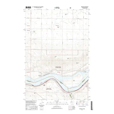
2017 Map of Wishram
USGS Topo · Published 2017About this map
The Columbia River serves as the focal point for this 2017 survey, marking the border between Washington and Oregon. The town of Wishram sits on the northern bank, a significant rail and river junction located where the canyon walls drop toward Lake Celilo. South of the river in Oregon, Celilo Village and Fulton Ridge represent a landscape defined by steep topography and historic river crossings.
Find a feature on this map
45 named features on this map. Tap any name to fly to it.
Don’t see what you’re looking for? This feature index may not catch every label — zoom into the map to look around manually.
Map Details
Editions of this 2017 Wishram Map
This is the sole edition of this map. No revisions or reprints were ever made.
Other maps of this area

1934 · The Dalles
USGS Topo · 1:125,000

1953 · The Dalles
USGS Topo · 1:250,000

1956 · The Dalles
USGS Topo · 1:250,000

1957 · The Dalles
USGS Topo · 1:250,000

1957 · Klickitat
USGS Topo · 1:62,500

1957 · Goldendale
USGS Topo · 1:62,500

1957 · The Dalles
USGS Topo · 1:62,500

1957 · Wishram
USGS Topo · 1:62,500

1974 · Stacker Butte
USGS Topo · 1:24,000
1974 · Locust Grove
USGS Topo · 1:24,000