2022 Map of Wister
USGS Topo · Published 2022About this map
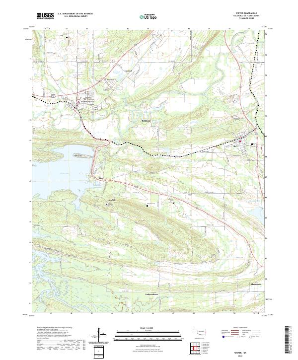
The Poteau River and its meandering tributaries define this portion of Le Flore County, where the sprawling waters of Wister Lake meet a landscape of ridges and valleys. Small settlements like Wister, Glendale, and Howe are clustered along the transportation corridors, including the Kansas City Southern railroad line. The map reveals a dense concentration of local heritage sites, particularly cemeteries such as Ellis Chapel Cem, Hoteyaby Cem, and McCurtain Cem, which are often located near small watercourses like Fanny Cr and Thompson Cr. From the heights of Potts Mtn in the south to the northern reach of Cavanai, the terrain transitions between agricultural bottomlands and wooded uplands, reflecting the rural character of southeastern Oklahoma as it persists into the early 21st century.
Find a feature on this map
125 named features on this map. Tap any name to fly to it.
Don’t see what you’re looking for? This feature index may not catch every label — zoom into the map to look around manually.
Map Details
Editions of this 2022 Wister Map
This is the sole edition of this map. No revisions or reprints were ever made.