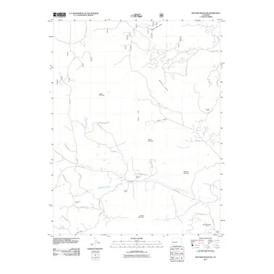
2011 Map of Witcher Mountain
USGS Topo · Published 2011About this map
Witcher Mountain and Mcintyre Mountain define a landscape of high summits and drainage basins in this 2011 survey of Park County. The map provides a detailed view of the high-altitude ranching and mining history of the region, featuring named operations such as the Rose Dawn Mine and legacy properties including Teaspoon Ranch, T Cross Ranch, and Nash Ranch. A complex network of watercourses, such as West Fourmile Creek and Bumgarner Creek, carves through the terrain, while landmarks like Saddle Mountain Pass indicate historic transit routes through the peaks. Human activity is further evidenced by the Dave Nash Ranch Airport and various recreational trails like Lakeview TRL and Elkhorn TRL, which wind around the slopes of Saddle Mountain. The inclusion of modern road names alongside older ranching labels offers a look at the transition between historic land use and contemporary rural residential life in the Colorado high country.
Find a feature on this map
49 named features on this map. Tap any name to fly to it.
Don’t see what you’re looking for? This feature index may not catch every label — zoom into the map to look around manually.
Map Details
Editions of this 2011 Witcher Mountain Map
This is the sole edition of this map. No revisions or reprints were ever made.
Other maps of this area

1894 · Pikes Peak
USGS Topo · 1:125,000

1901 · Pikes Peak
USGS Topo · 1:125,000

1942 · Cover Mtn.
USGS Topo · 1:62,500

1948 · Cover Mtn.
USGS Topo · 1:62,500

1954 · Pueblo
USGS Topo · 1:250,000

1956 · Lake George
USGS Topo · 1:24,000

1956 · Elevenmile Canyon
USGS Topo · 1:24,000

1956 · Spinney Mountain
USGS Topo · 1:24,000

1957 · Pueblo
USGS Topo · 1:250,000

1958 · Pueblo
USGS Topo · 1:250,000