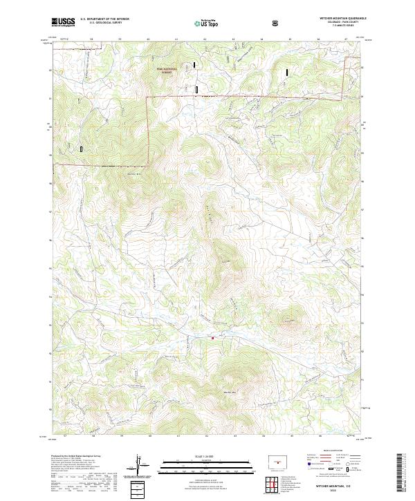
2022 Map of Witcher Mountain
USGS Topo · Published 2022About this map
Pike National Forest dominates the northern reaches of this Colorado landscape, where high elevations and complex drainage systems define the high-country character of Park County. The southern portion of the map is anchored by the prominent Witcher Mtn and Mcintyre Mtn, which overlook the valley of W Fourmile Cr. This area illustrates a transition from the preserved wilderness of the national forest to private landholdings, visible through the emerging residential road networks branching off Co RD 100 and Co RD 59.
Find a feature on this map
77 named features on this map. Tap any name to fly to it.
Don’t see what you’re looking for? This feature index may not catch every label — zoom into the map to look around manually.
Map Details
Editions of this 2022 Witcher Mountain Map
This is the sole edition of this map. No revisions or reprints were ever made.
Other maps of this area

1894 · Pikes Peak
USGS Topo · 1:125,000

1901 · Pikes Peak
USGS Topo · 1:125,000

1942 · Cover Mtn.
USGS Topo · 1:62,500

1948 · Cover Mtn.
USGS Topo · 1:62,500

1954 · Pueblo
USGS Topo · 1:250,000

1956 · Lake George
USGS Topo · 1:24,000

1956 · Elevenmile Canyon
USGS Topo · 1:24,000

1956 · Spinney Mountain
USGS Topo · 1:24,000

1957 · Pueblo
USGS Topo · 1:250,000

1958 · Pueblo
USGS Topo · 1:250,000