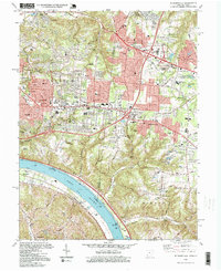
1996 Map of Withamsvile
USGS Topo · Published 1999About this map
The Ohio River valley south of Cincinnati defines this landscape during the late 1990s, where the winding water separates Ohio and Kentucky. Suburban growth from Anderson and Union townships presses against traditional landmarks like the St Gregorys Seminary and Newtown Cem. The map illustrates the transition from the riverfront industries of Melbourne and the Filtration Plant to the residential expansion around Cherry Grove and Withamsville.
Find a feature on this map
74 named features on this map. Tap any name to fly to it.
Don’t see what you’re looking for? This feature index may not catch every label — zoom into the map to look around manually.
Map Details
Editions of this 1996 Withamsvile Map
This is the sole edition of this map. No revisions or reprints were ever made.
Other maps of this area

1898 · East Cincinnati
USGS Topo · 1:62,500

1914 · East Cincinnati
USGS Topo · 1:62,500

1914 · Batavia
USGS Topo · 1:48,000

1916 · Batavia
USGS Topo · 1:62,500

1929 · Alexandria
USGS Topo · 1:48,000

1931 · Felicity
USGS Topo · 1:62,500

1936 · Alexandria
USGS Topo · 1:62,500

1952 · Newport
USGS Topo · 1:24,000

1953 · Laurel
USGS Topo · 1:24,000

1953 · Withamsville
USGS Topo · 1:24,000