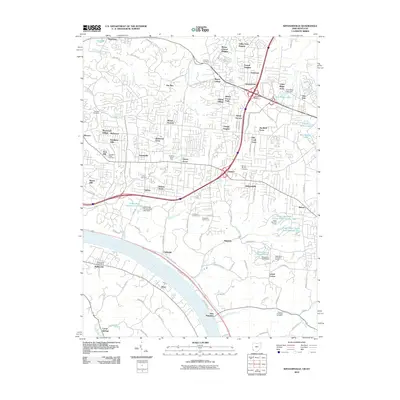
2010 Map of Withamsville
USGS Topo · Published 2010About this map
The Ohio River forms the southern boundary of this region, where the steep hillsides rising from the riverbank are carved by numerous waterways including Eightmile Creek, Ninemile Creek, and Tenmile Creek. The landscape transition from the river bottom toward the suburban heights of Withamsville and Cherry Grove is defined by a dense network of residential subdivisions such as Sherwood Village and Viking Village. This era of development is centered around the Eastgate Pavillion, yet older community anchors remain visible throughout the terrain. Genealogists and local historians can locate several established burial grounds, including Rose Hill Cemetery near Mount Carmel and the Pierce Township Cemetery to the southeast. The interior is marked by diverse land use, from the fairways of Vineyard Golf Course to the industrial and commercial nodes at Anderson Office Park and Melbourne Post Office along the Kentucky side of the river.
Find a feature on this map
117 named features on this map. Tap any name to fly to it.
Don’t see what you’re looking for? This feature index may not catch every label — zoom into the map to look around manually.
Map Details
Editions of this 2010 Withamsville Map
This is the sole edition of this map. No revisions or reprints were ever made.
Other maps of this area

1898 · East Cincinnati
USGS Topo · 1:62,500

1914 · East Cincinnati
USGS Topo · 1:62,500

1914 · Batavia
USGS Topo · 1:48,000

1916 · Batavia
USGS Topo · 1:62,500

1929 · Alexandria
USGS Topo · 1:48,000

1931 · Felicity
USGS Topo · 1:62,500

1936 · Alexandria
USGS Topo · 1:62,500

1952 · Newport
USGS Topo · 1:24,000

1953 · Laurel
USGS Topo · 1:24,000

1953 · Withamsville
USGS Topo · 1:24,000