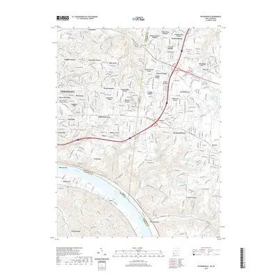
2019 Map of Withamsville
USGS Topo · Published 2019About this map
Cincinnati and its eastern suburbs are mapped here at a time of significant residential density and mature suburban development along the Ohio Pike. The landscape is defined by a series of residential estates and named subdivisions such as Lawyerdale Estates, Forest Hills Estates, and Am-Beth Acres, reflecting the 20th-century expansion from the urban core into the rolling hills of Hamilton County. Significant institutional land use is visible at The Athenaeum of Ohio and Mount Saint Mary's Seminary near Paddison Hills.
Find a feature on this map
74 named features on this map. Tap any name to fly to it.
Don’t see what you’re looking for? This feature index may not catch every label — zoom into the map to look around manually.
Map Details
Editions of this 2019 Withamsville Map
This is the sole edition of this map. No revisions or reprints were ever made.
Other maps of this area

1898 · East Cincinnati
USGS Topo · 1:62,500

1914 · East Cincinnati
USGS Topo · 1:62,500

1914 · Batavia
USGS Topo · 1:48,000

1916 · Batavia
USGS Topo · 1:62,500

1929 · Alexandria
USGS Topo · 1:48,000

1931 · Felicity
USGS Topo · 1:62,500

1936 · Alexandria
USGS Topo · 1:62,500

1952 · Newport
USGS Topo · 1:24,000

1953 · Laurel
USGS Topo · 1:24,000

1953 · Withamsville
USGS Topo · 1:24,000