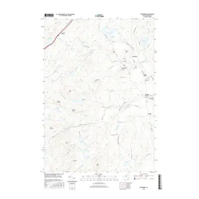
2016 Map of Witherbee
USGS Topo · Published 2016About this map
The Adirondack town of Moriah and its industrial satellites define this survey of the eastern Adirondack Mountains. Settlements like Mineville and Witherbee are established against a backdrop of steep peaks including Belfry Mtn and Mt Tom, indicating a landscape where mining and mountain terrain have long coexisted. The concentration of local roads such as Dynamite Ln and Furnace Rd near these communities provides a direct link to the area's history of iron extraction and processing.
Find a feature on this map
84 named features on this map. Tap any name to fly to it.
Don’t see what you’re looking for? This feature index may not catch every label — zoom into the map to look around manually.
Map Details
Editions of this 2016 Witherbee Map
This is the sole edition of this map. No revisions or reprints were ever made.
Other maps of this area

1894 · Elizabethtown
USGS Topo · 1:62,500

1894 · Port Henry
USGS Topo · 1:62,500

1894 · Ticonderoga
USGS Topo · 1:62,500

1895 · Elizabethtown
USGS Topo · 1:62,500

1895 · Paradox Lake
USGS Topo · 1:62,500

1896 · Ticonderoga
USGS Topo · 1:62,500

1897 · Paradox Lake
USGS Topo · 1:62,500

1898 · Port Henry
USGS Topo · 1:62,500

1901 · Elizabethtown
USGS Topo · 1:62,500

1902 · Ticonderoga
USGS Topo · 1:62,500