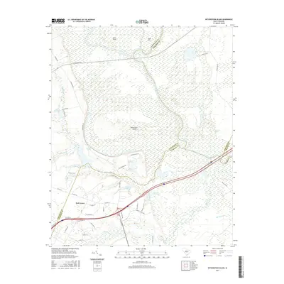
2017 Map of Witherspoon Island
USGS Topo · Published 2017About this map
Witherspoon Island dominates the center of this map, defined by the winding course of the Great Pee Dee River and its intricate network of backwaters. The landscape is a mosaic of wetlands and oxbow lakes, including Lowthers Lake and Rogers Lake, illustrating the river's historical migration through the coastal plain. In the southern portion of the quadrangle, the community of Back Swamp sits near the confluence of Black Creek and the river, while the modern infrastructure of Interstate 95 cuts across the terrain near the I 95 Rest Area Lagoon. Local features like Wachovia Hills Lake and The Little Lakes provide fine-grained detail for those studying the specific hydrology and land use patterns of this riverine environment in the early 21st century.
Find a feature on this map
53 named features on this map. Tap any name to fly to it.
Don’t see what you’re looking for? This feature index may not catch every label — zoom into the map to look around manually.
Map Details
Editions of this 2017 Witherspoon Island Map
This is the sole edition of this map. No revisions or reprints were ever made.
Other maps of this area

1940 · Florence West
USGS Topo · 1:62,500

1940 · Florence East
USGS Topo · 1:62,500

1943 · Gum Swamp
USGS Topo · 1:62,500

1945 · Florence East
USGS Topo · 1:62,500

1945 · Florence West
USGS Topo · 1:62,500

1953 · Florence
USGS Topo · 1:250,000

1954 · Florence
USGS Topo · 1:250,000

1963 · Mont Clare
USGS Topo · 1:24,000

1963 · Darlington East
USGS Topo · 1:24,000

1972 · Drake
USGS Topo · 1:24,000