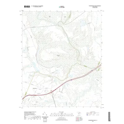
2020 Map of Witherspoon Island
USGS Topo · Published 2020About this map
The Great Pee Dee River dominates this landscape, winding through a complex network of wetlands and riverine features where Darlington, Florence, and Marlboro counties meet. The river's path creates distinct landforms such as Witherspoon Island, Byrds Island, and the prominent Wachovia Bluff. The intricate hydrology of the region is evident in the numerous oxbow lakes and wetlands, including Lowthers Lake, Rogers Lake, and the expansive Back Swamp.
Find a feature on this map
53 named features on this map. Tap any name to fly to it.
Don’t see what you’re looking for? This feature index may not catch every label — zoom into the map to look around manually.
Map Details
Editions of this 2020 Witherspoon Island Map
This is the sole edition of this map. No revisions or reprints were ever made.
Other maps of this area

1940 · Florence West
USGS Topo · 1:62,500

1940 · Florence East
USGS Topo · 1:62,500

1943 · Gum Swamp
USGS Topo · 1:62,500

1945 · Florence East
USGS Topo · 1:62,500

1945 · Florence West
USGS Topo · 1:62,500

1953 · Florence
USGS Topo · 1:250,000

1954 · Florence
USGS Topo · 1:250,000

1963 · Mont Clare
USGS Topo · 1:24,000

1963 · Darlington East
USGS Topo · 1:24,000

1972 · Drake
USGS Topo · 1:24,000