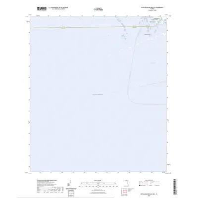
2024 Map of Withlacoochee Bay OE S
USGS Topo · Published 2024About this map
The coastal transition where the Withlacoochee River meets the Gulf of Mexico is the focal point of this coastal survey. Near the mouth of the river, the settlements of Yankeetown and Port Inglis serve as the primary gateways to the Gulf, situated just north of the county boundary between Levy Co and Citrus Co. The shoreline is characterized by a complex network of small keys and tidal passages, including Deadman Key and Chambers Island, which guard the river's entrance via Bungalow Pass and East Pass.
Find a feature on this map
10 named features on this map. Tap any name to fly to it.
Don’t see what you’re looking for? This feature index may not catch every label — zoom into the map to look around manually.
Map Details
Editions of this 2024 Withlacoochee Bay OE S Map
This is the sole edition of this map. No revisions or reprints were ever made.
Other maps of this area

1954 · Red Level
USGS Topo · 1:24,000

1954 · Ozello
USGS Topo · 1:24,000

1954 · Gainesville
USGS Topo · 1:250,000

1955 · Withlacoochee Bay
USGS Topo · 1:24,000

1955 · Yankeetown
USGS Topo · 1:24,000

1955 · Plant City
USGS Topo · 1:250,000

1958 · Plant City
USGS Topo · 1:250,000

1958 · Gainesville
USGS Topo · 1:250,000

1959 · Plant City
USGS Topo · 1:250,000

1959 · Gainesville
USGS Topo · 1:250,000