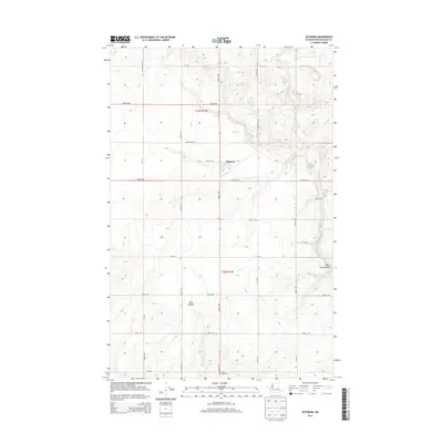
2014 Map of Withrow
USGS Topo · Published 2014About this map
The agricultural landscape of the Waterville Plateau is defined by the high-desert wheat fields surrounding the community of Withrow. This 2014 survey documents the grid of section-line roads, such as Christenson Rd NW and Potter Rd NW, that facilitate the region’s dryland farming economy. The terrain shifts from flat upland plains to the sharp topographical breaks of Pine Canyon and the winding course of Dutch Henry Draw, illustrating the stark transition between arable plateaus and the deep coulees that mark the Big Bend country.
Find a feature on this map
29 named features on this map. Tap any name to fly to it.
Don’t see what you’re looking for? This feature index may not catch every label — zoom into the map to look around manually.
Map Details
Editions of this 2014 Withrow Map
This is the sole edition of this map. No revisions or reprints were ever made.
Other maps of this area

1953 · Ritzville
USGS Topo · 1:250,000

1959 · Ritzville
USGS Topo · 1:250,000

1965 · Ritzville
USGS Topo · 1:250,000

1965 · Jameson Lake SW
USGS Topo · 1:24,000

1965 · Jameson Lake West
USGS Topo · 1:24,000

1968 · Withrow
USGS Topo · 1:24,000

1968 · Lamoine
USGS Topo · 1:24,000

1968 · Chelan Falls
USGS Topo · 1:24,000
1968 · Alstown
USGS Topo · 1:24,000
1968 · Mud Spring
USGS Topo · 1:24,000