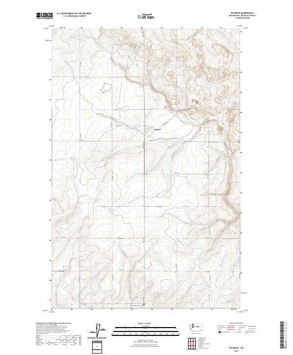
2023 Map of Withrow
USGS Topo · Published 2023About this map
Withrow serves as the central hub of this agricultural landscape in Douglas County, situated at the intersection of Berg Rd and Rd C NW. The terrain is defined by the sweeping course of Dutch Henry Draw, which meanders through the northern sections of the township. This map illustrates a highly organized grid of rural roads, such as Rd 6 NW and Rd 4 NW, which partition the land into regular sections characteristic of the high plateau country of central Washington. A notable point of local history is the Farmer Happy Home Cem, located in the southern portion of the quadrangle near 1st Rd NW. This site, along with the scattered farmstead road network including Withrow Rd NW, provides a detailed record of the settlement patterns and land use in this part of the Pacific Northwest.
Find a feature on this map
24 named features on this map. Tap any name to fly to it.
Don’t see what you’re looking for? This feature index may not catch every label — zoom into the map to look around manually.
Map Details
Editions of this 2023 Withrow Map
This is the sole edition of this map. No revisions or reprints were ever made.
Other maps of this area

1953 · Ritzville
USGS Topo · 1:250,000

1959 · Ritzville
USGS Topo · 1:250,000

1965 · Ritzville
USGS Topo · 1:250,000

1965 · Jameson Lake SW
USGS Topo · 1:24,000

1965 · Jameson Lake West
USGS Topo · 1:24,000

1968 · Withrow
USGS Topo · 1:24,000

1968 · Lamoine
USGS Topo · 1:24,000

1968 · Chelan Falls
USGS Topo · 1:24,000
1968 · Alstown
USGS Topo · 1:24,000
1968 · Mud Spring
USGS Topo · 1:24,000