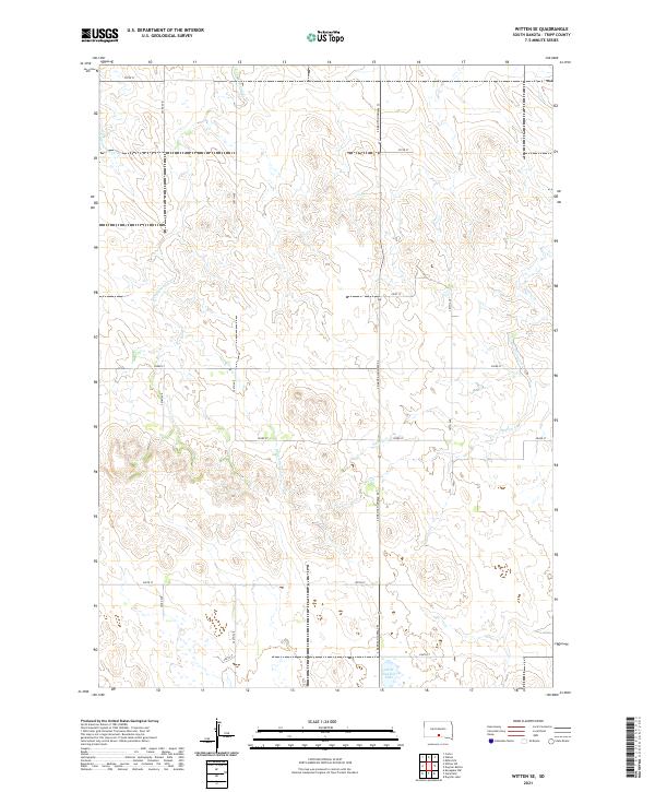
2021 Map of Witten SE
USGS Topo · Published 2021About this map
Little Dog Ear Lake anchors the southern reaches of this Tripp County landscape, situated in a region defined by its subtle drainage networks and section-line road grid. The map illustrates a transitional prairie environment where small ephemeral waterways like E Cottonwood Cr and W Cottonwood Cr carve shallow paths through the terrain. Evidence of the Public Land Survey System is omnipresent, with township lines for t98n r78w and t99n r78w framing the agricultural allotments. S Dakota Highway 53 provides the primary north-south corridor, intersecting a network of gravel roads including 283rd St and 304th Ave. This recent survey by the U.S. Geological Survey captures the persistent rural character of the South Dakota plains, where Hollow Cr and other small drainages dictate the local topography between scattered farmsteads.
Find a feature on this map
21 named features on this map. Tap any name to fly to it.
Don’t see what you’re looking for? This feature index may not catch every label — zoom into the map to look around manually.
Map Details
Editions of this 2021 Witten SE Map
This is the sole edition of this map. No revisions or reprints were ever made.
Other maps of this area

1955 · Martin
USGS Topo · 1:250,000

1955 · Mitchell
USGS Topo · 1:250,000

1958 · Martin
USGS Topo · 1:250,000

1959 · Mitchell
USGS Topo · 1:250,000

1982 · Witten SE
USGS Topo · 1:25,000

1982 · Witten
USGS Topo · 1:25,000
1982 · Miller Hill
USGS Topo · 1:25,000

1982 · Witten SW
USGS Topo · 1:25,000
1982 · Clearfield
USGS Topo · 1:24,000
1982 · Keyapaha NW
USGS Topo · 1:24,000