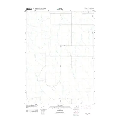
2012 Map of Witten SW
USGS Topo · Published 2012About this map
E White Horse Cr and De Bell Cr define the drainage of this segment of the Great Plains, where the terrain is marked by a precise network of sectional roads. This landscape reflects the enduring influence of the Public Land Survey System, with gravel and dirt roads like 285th St and 300th Ave forming a grid that dictates the placement of rural homesteads and agricultural boundaries. The seasonal watercourses, including W Cottonwood Cr and Willow Cr, carve subtle draws across the prairie, providing the only break in the geometric regularity of the section lines. This area represents the open, ranching-oriented geography of south-central South Dakota, where the placement of infrastructure remains tethered to the original township and range surveys.
Find a feature on this map
17 named features on this map. Tap any name to fly to it.
Don’t see what you’re looking for? This feature index may not catch every label — zoom into the map to look around manually.
Map Details
Editions of this 2012 Witten SW Map
This is the sole edition of this map. No revisions or reprints were ever made.
Other maps of this area

1955 · Martin
USGS Topo · 1:250,000

1958 · Martin
USGS Topo · 1:250,000

1982 · Witten SE
USGS Topo · 1:25,000

1982 · Witten
USGS Topo · 1:25,000

1982 · Witten SW
USGS Topo · 1:25,000
1982 · Clearfield
USGS Topo · 1:24,000

1982 · Okreek SE
USGS Topo · 1:24,000
1982 · Keyapaha NW
USGS Topo · 1:24,000
1982 · Carter
USGS Topo · 1:25,000

1982 · Mosher
USGS Topo · 1:25,000