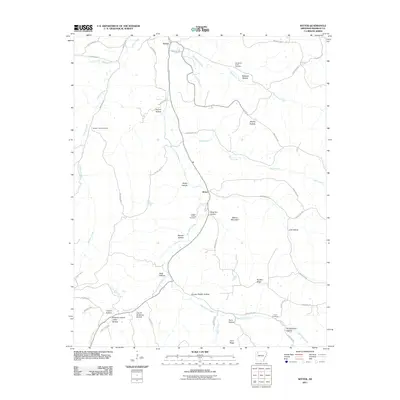
2011 Map of Witter
USGS Topo · Published 2011About this map
War Eagle Creek and its many winding tributaries define the topography of this Madison County landscape, where deep hollows and high ridges dictate the local road network. The small settlements of Aurora and Witter serve as the primary hubs, connected by a web of county routes and state roads that trace the natural contours of the land. This 2011 survey reveals a high density of family and community landmarks, particularly evident in the naming of topographical features like Granny Paddin Hollow, Slow Tom Hollow, and Pennywinkle Hollow. Several burial sites, including Jackson Creek Cemetery and Captain Smiths Cemetery, are preserved on the map, providing essential location data for genealogists. The terrain is marked by significant elevations such as Moore Mountain and Nubbin Ridge, which overlook the creek valleys and the agricultural parcels tucked between them.
Find a feature on this map
57 named features on this map. Tap any name to fly to it.
Don’t see what you’re looking for? This feature index may not catch every label — zoom into the map to look around manually.
Map Details
Editions of this 2011 Witter Map
This is the sole edition of this map. No revisions or reprints were ever made.
Other maps of this area

1900 · Eureka Springs
USGS Topo · 1:125,000

1901 · Eureka Springs
USGS Topo · 1:125,000

1943 · St. Paul
USGS Topo · 1:62,500

1945 · Harrison
USGS Topo · 1:250,000

1946 · St. Paul
USGS Topo · 1:62,500

1949 · Harrison
USGS Topo · 1:250,000

1954 · Harrison
USGS Topo · 1:250,000

1956 · Russellville
USGS Topo · 1:250,000

1958 · Harrison
USGS Topo · 1:250,000

1964 · Russellville
USGS Topo · 1:250,000