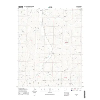
2017 Map of Witter
USGS Topo · Published 2017About this map
War Eagle Creek and the Dry Fork define the drainage of this Madison County landscape, where small communities like Aurora and Witter follow the valley floors. The terrain is deeply incised by family-named and descriptively named landforms, including Granny Paddin Hollow, Slow Tom Hollow, and Pennywinkle Hollow, suggesting a long history of local settlement and naming traditions. High points such as Venus Mountain and Moore Mountain overlook a network of county roads that connect these remote hollows. For genealogists, the map preserves the locations of several community burial grounds, including Henderson Creek Cemetery, Jackson Creek Cemetery, and Captain Smiths Cemetery. The density of named hollows like Carroll Anderson Hollow and Jackie Hollow points to the legacy of specific families who established homesteads along the tributaries of the War Eagle Creek watershed.
Find a feature on this map
88 named features on this map. Tap any name to fly to it.
Don’t see what you’re looking for? This feature index may not catch every label — zoom into the map to look around manually.
Map Details
Editions of this 2017 Witter Map
This is the sole edition of this map. No revisions or reprints were ever made.
Other maps of this area

1900 · Eureka Springs
USGS Topo · 1:125,000

1901 · Eureka Springs
USGS Topo · 1:125,000

1943 · St. Paul
USGS Topo · 1:62,500

1945 · Harrison
USGS Topo · 1:250,000

1946 · St. Paul
USGS Topo · 1:62,500

1949 · Harrison
USGS Topo · 1:250,000

1954 · Harrison
USGS Topo · 1:250,000

1956 · Russellville
USGS Topo · 1:250,000

1958 · Harrison
USGS Topo · 1:250,000

1964 · Russellville
USGS Topo · 1:250,000