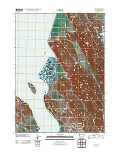
2011 Map of Wocus
USGS Topo · Published 2011About this map
Upper Klamath Lake dominates the western half of this landscape, its waters meeting a complex shoreline defined by features like Cove Point, The Neck, and Buck Island. The eastern shore serves as a primary corridor for transportation and settlement, where the community of Algoma sits at the foot of Naylox Mountain. This area is marked by a legacy of industrial infrastructure, evidenced by Algoma Siding and the Algoma Incline rising toward the north.
Find a feature on this map
54 named features on this map. Tap any name to fly to it.
Don’t see what you’re looking for? This feature index may not catch every label — zoom into the map to look around manually.
Map Details
Editions of this 2011 Wocus Map
This is the sole edition of this map. No revisions or reprints were ever made.
Other maps of this area

1889 · Klamath
USGS Topo · 1:250,000

1894 · Klamath
USGS Topo · 1:250,000

1955 · Klamath Falls
USGS Topo · 1:250,000

1957 · Merrill
USGS Topo · 1:62,500

1957 · Swan Lake
USGS Topo · 1:62,500

1957 · Klamath Falls
USGS Topo · 1:62,500

1957 · Modoc Point
USGS Topo · 1:62,500

1958 · Klamath Falls
USGS Topo · 1:250,000
1975 · Klamath Falls NE
USGS Topo · 1:24,000

1975 · Merrill NW
USGS Topo · 1:24,000