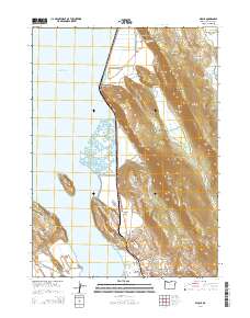
2014 Map of Wocus
USGS Topo · Published 2014About this map
Upper Klamath Lake dominates the western horizon of this quadrangle, where the rugged eastern shoreline meets the dramatic rises of Naylox Mtn and the Plum Hills. The landscape is a study in verticality and infrastructure, evidenced by the Algoma Incline which underscores the area's history of transport and industry near the settlement of Algoma. Along the shoreline, prominent landmarks like Rattlesnake Point and Cove Point transition into the flat reaches of Rabbit Flat, while the interior is marked by deep cuts like Hell for Slim Draw and Simpson Canyon.
Find a feature on this map
76 named features on this map. Tap any name to fly to it.
Don’t see what you’re looking for? This feature index may not catch every label — zoom into the map to look around manually.
Map Details
Editions of this 2014 Wocus Map
This is the sole edition of this map. No revisions or reprints were ever made.
Other maps of this area

1889 · Klamath
USGS Topo · 1:250,000

1894 · Klamath
USGS Topo · 1:250,000

1955 · Klamath Falls
USGS Topo · 1:250,000

1957 · Merrill
USGS Topo · 1:62,500

1957 · Swan Lake
USGS Topo · 1:62,500

1957 · Klamath Falls
USGS Topo · 1:62,500

1957 · Modoc Point
USGS Topo · 1:62,500

1958 · Klamath Falls
USGS Topo · 1:250,000
1975 · Klamath Falls NE
USGS Topo · 1:24,000

1975 · Merrill NW
USGS Topo · 1:24,000