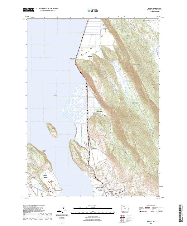
2024 Map of Wocus
USGS Topo · Published 2024About this map
Upper Klamath National Wildlife Refuge dominates the western shoreline of this landscape, where the shallow waters of Upper Klamath Lake transition into the expansive Hanks Marsh. This 2024 map documents a complex topographical area where steep ridges like Naylox Mtn and the Plum Hills overlook the northwestern outskirts of Klamath Falls. The presence of the Algoma Incline suggests the region's historical industrial activities, while the modern campus of the Oregon Institute of Technology sits prominently near Pelican City. Northward along the lake, small settlements and developments such as Shady Pine, Rabbit Flat, and Algoma follow the curve of the shoreline. The southwestern portion of the sheet is defined by the Running Y Ranch and the protected basin of Wocus Marsh, illustrating the continued importance of land management and recreation in this Oregon lakefront environment.
Find a feature on this map
67 named features on this map. Tap any name to fly to it.
Don’t see what you’re looking for? This feature index may not catch every label — zoom into the map to look around manually.
Map Details
Editions of this 2024 Wocus Map
This is the sole edition of this map. No revisions or reprints were ever made.
Other maps of this area

1889 · Klamath
USGS Topo · 1:250,000

1894 · Klamath
USGS Topo · 1:250,000

1955 · Klamath Falls
USGS Topo · 1:250,000

1957 · Merrill
USGS Topo · 1:62,500

1957 · Swan Lake
USGS Topo · 1:62,500

1957 · Klamath Falls
USGS Topo · 1:62,500

1957 · Modoc Point
USGS Topo · 1:62,500

1958 · Klamath Falls
USGS Topo · 1:250,000
1975 · Klamath Falls NE
USGS Topo · 1:24,000

1975 · Merrill NW
USGS Topo · 1:24,000