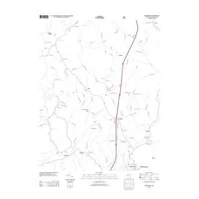
2013 Map of Wofford
USGS Topo · Published 2013About this map
The Cumberland River snakes through the heart of Whitley County, creating dramatic loops such as Prewitt Bend and Croley Bend. This 2013 topographic survey documents the terrain surrounding Williamsburg, including the distinct neighborhoods of Highland Park and the settlement of Goldbug. The landscape is a network of small watercourses like Bark Camp Cr, Blake Fork, and Rough Shoals Cr that define the local geography. Aviation facilities are notable here, with both the Williamsburg-Whitley County Airport and the smaller Carr Airport serving the region. For those researching family history, the map identifies several local burial sites, including Youngs Cem, Ryan Cem, and Steely Cem. The presence of the Gatliff State Fish Hatchery near Wofford highlights the area's continued use for conservation and resource management, while the elevation of King Mountain stands as a prominent landmark in the southeast.
Find a feature on this map
110 named features on this map. Tap any name to fly to it.
Don’t see what you’re looking for? This feature index may not catch every label — zoom into the map to look around manually.
Map Details
Editions of this 2013 Wofford Map
This is the sole edition of this map. No revisions or reprints were ever made.
Other maps of this area

1890 · Williamsburg
USGS Topo · 1:125,000

1894 · Williamsburg
USGS Topo · 1:125,000

1952 · Corbin
USGS Topo · 1:24,000

1952 · Wofford
USGS Topo · 1:24,000

1952 · Vox
USGS Topo · 1:24,000

1952 · Saxton
USGS Topo · 1:24,000

1952 · Hollyhill
USGS Topo · 1:24,000

1952 · Rockholds
USGS Topo · 1:24,000

1952 · Cumberland Falls
USGS Topo · 1:24,000

1952 · Williamsburg
USGS Topo · 1:24,000