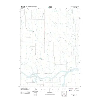
2011 Map of Wolbach SW
USGS Topo · Published 2011About this map
The North Loup River and Middle Loup River converge to form the Loup River in this rural section of Howard County, defining the hydrologic character of the plains. This landscape is marked by a network of drainage systems, including Cady Creek, Cedar Creek, and Spring Creek, which are supplemented by man-made agricultural infrastructure such as Miller Reservoir and Kolar Reservoir. For genealogists, the map preserves the locations of several community landmarks, including Saint Peter Cemetery in the north and Logan Cemetery further south. The straight-line grid of rural roads like Cushing Rd and Inman Rd illustrates the late-twentieth-century parceling of Nebraska farmland, providing a precise spatial context for family homesteads and local history research.
Find a feature on this map
33 named features on this map. Tap any name to fly to it.
Don’t see what you’re looking for? This feature index may not catch every label — zoom into the map to look around manually.
Map Details
Editions of this 2011 Wolbach SW Map
This is the sole edition of this map. No revisions or reprints were ever made.
Other maps of this area

1899 · Loup
USGS Topo · 1:125,000

1899 · St. Paul
USGS Topo · 1:125,000

1953 · Scotia NE
USGS Topo · 1:24,000

1953 · Nysted
USGS Topo · 1:24,000

1953 · Elba
USGS Topo · 1:24,000

1954 · Wolbach
USGS Topo · 1:24,000

1954 · Wolbach NE
USGS Topo · 1:24,000

1955 · Broken Bow
USGS Topo · 1:250,000

1955 · Wolbach SW
USGS Topo · 1:24,000

1955 · Cushing
USGS Topo · 1:24,000