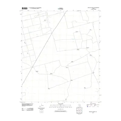
2010 Map of Wolcott Ranch
USGS Topo · Published 2010About this map
Wolcott Ranch and Hyatt Ranch anchor this West Texas landscape, reflecting a region where large-scale ranching and industrial extraction coexist. The map highlights the Breedlove Oil Field in the north, a testament to the petroleum economy that has long shaped Martin County. This area is characterized by its vital water infrastructure, necessary for sustaining livestock and industry in an arid environment. The sheer density of named water sources, such as Dynamite Windmill, Budwizer Windmill, and North Tank Windmill, illustrates how essential managed water access is to the local geography. Natural features like North Lake and the drainage of McKenzie Draw provide the only significant relief in a terrain otherwise defined by a grid of county roads, including Sun RD and Co RD 4800. These landmarks serve as the primary navigational and organizational points for residents and workers across the expansive ranch lands.
Find a feature on this map
26 named features on this map. Tap any name to fly to it.
Don’t see what you’re looking for? This feature index may not catch every label — zoom into the map to look around manually.
Map Details
Editions of this 2010 Wolcott Ranch Map
This is the sole edition of this map. No revisions or reprints were ever made.
Other maps of this area

1954 · Hobbs
USGS Topo · 1:250,000

1954 · Big Spring
USGS Topo · 1:250,000

1958 · Big Spring
USGS Topo · 1:250,000

1958 · Hobbs
USGS Topo · 1:250,000

1966 · Wolcott Ranch
USGS Topo · 1:24,000

1966 · Lenorah West
USGS Topo · 1:24,000

1966 · Flynt Ranch
USGS Topo · 1:24,000

1966 · Flower Grove
USGS Topo · 1:24,000

1966 · Scharbauer Ranch
USGS Topo · 1:24,000

1966 · Bird Ranch
USGS Topo · 1:24,000