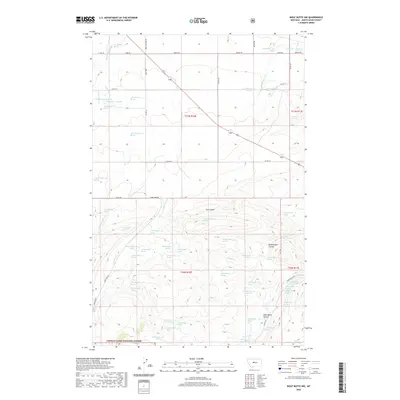
2020 Map of Wolf Butte NW
USGS Topo · Published 2020About this map
The Lewis & Clark National Forest defines the southern portion of this landscape, where the terrain breaks into complex drainages and coulees. High-country water sources are the lifeblood of this Judith Basin County area, evidenced by a high density of named springs such as 16N10E12CB 01 Spring and 17N10E08CC 02 Spring. These water points serve a series of seasonal creek beds, including McCarthy Cr, Shannon Cr, and the winding Lone Tree Cr, which together dictate the ranching and agricultural patterns of the region.
Find a feature on this map
73 named features on this map. Tap any name to fly to it.
Don’t see what you’re looking for? This feature index may not catch every label — zoom into the map to look around manually.
Map Details
Editions of this 2020 Wolf Butte NW Map
This is the sole edition of this map. No revisions or reprints were ever made.
Other maps of this area

1890 · Fort Benton
USGS Topo · 1:250,000

1892 · Fort Benton
USGS Topo · 1:250,000

1897 · Fort Benton
USGS Topo · 1:250,000

1954 · Great Falls
USGS Topo · 1:250,000

1957 · Great Falls
USGS Topo · 1:250,000
1961 · Mixes Baldy
USGS Topo · 1:24,000
1961 · The Arch
USGS Topo · 1:24,000

1961 · Barker
USGS Topo · 1:62,500

1978 · Leiberg Coulee
USGS Topo · 1:24,000
1978 · Byrne Creek
USGS Topo · 1:24,000