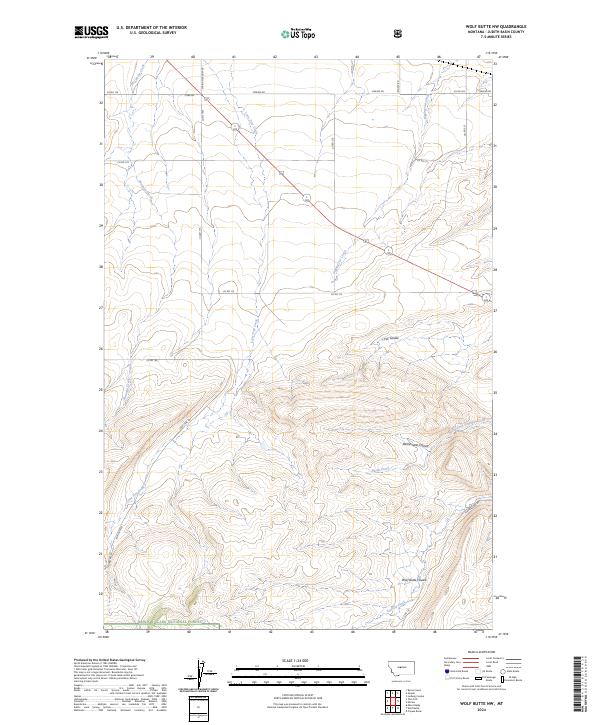
2024 Map of Wolf Butte NW
USGS Topo · Published 2024About this map
The boundary of the Lewis & Clark National Forest transitions into a high-elevation landscape defined by deep drainage systems in this Judith Basin survey. The northern reaches of the quadrangle are characterized by a network of rural routes, including Cobb Rd and Merino Rd, while the southern terrain is marked by a series of significant coulees that shape the cattle and ranching country. These landforms, such as Wolf Butte Coulee, Rattlesnake Coulee, and Fox Coulee, provide a clear picture of the water-cut topography that defines central Montana's geography. The map traces multiple waterways that feed these systems, most notably the long path of Lone Tree Creek and the southern flow of Surprise Creek, reflecting the essential relationship between water sources and land use in this part of the state.
Find a feature on this map
31 named features on this map. Tap any name to fly to it.
Don’t see what you’re looking for? This feature index may not catch every label — zoom into the map to look around manually.
Map Details
Editions of this 2024 Wolf Butte NW Map
This is the sole edition of this map. No revisions or reprints were ever made.
Other maps of this area

1890 · Fort Benton
USGS Topo · 1:250,000

1892 · Fort Benton
USGS Topo · 1:250,000

1897 · Fort Benton
USGS Topo · 1:250,000

1954 · Great Falls
USGS Topo · 1:250,000

1957 · Great Falls
USGS Topo · 1:250,000
1961 · Mixes Baldy
USGS Topo · 1:24,000
1961 · The Arch
USGS Topo · 1:24,000

1961 · Barker
USGS Topo · 1:62,500

1978 · Leiberg Coulee
USGS Topo · 1:24,000
1978 · Byrne Creek
USGS Topo · 1:24,000