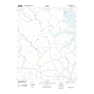
2010 Map of Wolf Creek Dam
USGS Topo · Published 2010About this map
The Wolf Creek Dam and its resulting reservoir, Lake Cumberland, dominate the eastern landscape of this Clinton County region as it appeared in the early 21st century. The complex shoreline of the lake reaches into deep hollows such as McCoy Hollow and Wolf Hollow, reflecting the dramatic elevation changes of the Cumberland Plateau. While the modern dam structure defines the local economy, evidence of an older, river-dependent life remains visible at Winfreys Ferry and across agricultural flats like Rockhouse Bottom and Salt Lick Bottom.
Find a feature on this map
66 named features on this map. Tap any name to fly to it.
Don’t see what you’re looking for? This feature index may not catch every label — zoom into the map to look around manually.
Map Details
Editions of this 2010 Wolf Creek Dam Map
This is the sole edition of this map. No revisions or reprints were ever made.
Other maps of this area

1924 · Lillydale
USGS Topo · 1:62,500

1926 · Lillydale
USGS Topo · 1:62,500

1929 · Lillydale
USGS Topo · 1:62,500

1929 · Byrdstown
USGS Topo · 1:62,500

1953 · Amandaville
USGS Topo · 1:24,000

1953 · Burkesville
USGS Topo · 1:24,000

1953 · Wolf Creek Dam
USGS Topo · 1:24,000

1953 · Creelsboro
USGS Topo · 1:24,000

1953 · Jamestown
USGS Topo · 1:24,000

1954 · Frogue
USGS Topo · 1:24,000