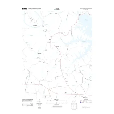
2013 Map of Wolf Creek Dam
USGS Topo · Published 2013About this map
Lake Cumberland dominates the northeastern reaches of this landscape, its intricate shoreline held back by the massive Wolf Creek Dam. The terrain is defined by a network of ridges and hollows, such as Greenbrier Ridge and McCoy Hollow, which dictate the paths of rural transit and settlement. Small communities and named crossroads are scattered throughout the region, including Desda, Aaron, and the curiously named Seventy Six near Seventy Six Falls.
Find a feature on this map
100 named features on this map. Tap any name to fly to it.
Don’t see what you’re looking for? This feature index may not catch every label — zoom into the map to look around manually.
Map Details
Editions of this 2013 Wolf Creek Dam Map
This is the sole edition of this map. No revisions or reprints were ever made.
Other maps of this area

1924 · Lillydale
USGS Topo · 1:62,500

1926 · Lillydale
USGS Topo · 1:62,500

1929 · Lillydale
USGS Topo · 1:62,500

1929 · Byrdstown
USGS Topo · 1:62,500

1953 · Amandaville
USGS Topo · 1:24,000

1953 · Burkesville
USGS Topo · 1:24,000

1953 · Wolf Creek Dam
USGS Topo · 1:24,000

1953 · Creelsboro
USGS Topo · 1:24,000

1953 · Jamestown
USGS Topo · 1:24,000

1954 · Frogue
USGS Topo · 1:24,000