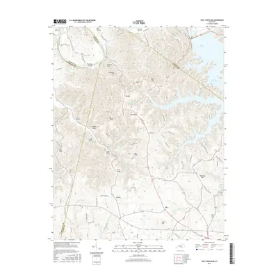
2016 Map of Wolf Creek Dam
USGS Topo · Published 2016About this map
Wolf Creek Dam and the expansive waters of Lake Cumberland dominate the northeast corner of this Clinton County landscape, where the Cumberland River corridor marks the boundary between Russell and Cumberland counties. The terrain is characterized by a series of prominent ridges and bottoms, such as Greenbrier Ridge and Irish Bottom, which have historically shaped the local settlement patterns. Small communities like Desda, Willis Creek, and Seventy Six are connected by a network of rural roads that navigate the complex topography of hollows and ridges. Genealogists will find several family-named landmarks and burial sites, including Lewis Cem and Hilltop Cem, located near the village of Snow. The presence of Seventy Six Falls along Indian Cr highlights the area's natural drainage system, while names like Decide and Ida reflect the distinct local nomenclature of south-central Kentucky.
Find a feature on this map
88 named features on this map. Tap any name to fly to it.
Don’t see what you’re looking for? This feature index may not catch every label — zoom into the map to look around manually.
Map Details
Editions of this 2016 Wolf Creek Dam Map
This is the sole edition of this map. No revisions or reprints were ever made.
Other maps of this area

1924 · Lillydale
USGS Topo · 1:62,500

1926 · Lillydale
USGS Topo · 1:62,500

1929 · Lillydale
USGS Topo · 1:62,500

1929 · Byrdstown
USGS Topo · 1:62,500

1953 · Amandaville
USGS Topo · 1:24,000

1953 · Burkesville
USGS Topo · 1:24,000

1953 · Wolf Creek Dam
USGS Topo · 1:24,000

1953 · Creelsboro
USGS Topo · 1:24,000

1953 · Jamestown
USGS Topo · 1:24,000

1954 · Frogue
USGS Topo · 1:24,000