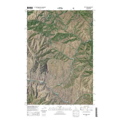
2013 Map of Wolf Creek
USGS Topo · Published 2013About this map
Spring Camp Ranch and Davidson anchor the high ground above the canyon systems in this rugged section of the Idaho-Oregon border. The landscape is defined by the steep descent toward the Snake River, where the water transitions through Five-Mile Rapids and Ragtown Bar Rapids. This terrain dictated the placement of early homesteads and seasonal camps, such as the Mexican Place and Christmas Creek Camp, which are situated near critical water sources like Wolf Cr and White Bird Cr.
Find a feature on this map
51 named features on this map. Tap any name to fly to it.
Don’t see what you’re looking for? This feature index may not catch every label — zoom into the map to look around manually.
Map Details
Editions of this 2013 Wolf Creek Map
This is the sole edition of this map. No revisions or reprints were ever made.
Other maps of this area

1954 · Kernan Point
USGS Topo · 1:62,500

1955 · Grangeville
USGS Topo · 1:250,000

1959 · Grangeville
USGS Topo · 1:250,000

1963 · Cactus Mtn
USGS Topo · 1:24,000

1963 · Boles
USGS Topo · 1:24,000

1963 · Rattlesnake Ridge
USGS Topo · 1:24,000

1963 · Moughmer Point
USGS Topo · 1:24,000

1963 · Joseph
USGS Topo · 1:24,000

1963 · Grave Point
USGS Topo · 1:24,000

1963 · Wolf Creek
USGS Topo · 1:24,000