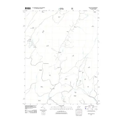
2011 Map of Wolf Gap
USGS Topo · Published 2011About this map
Liberty Furnace and the Old Iron Furnace anchor the southern reaches of this landscape, marking the historic industrial activity near the headwaters of Stony Creek. The region is defined by prominent north-south ridges including Long Mountain, Devils Hole Mountain, and Bowers Mountain, which funnel drainage into several distinct valley systems. Settlement is sparse, centered on the small communities of Perry and Rockland, while recreational and transport infrastructure like Ayers Airport, Trout Pond Campground, and Camp Strawderman suggest the area's modern role as a destination for outdoor activity. The presence of several dams, such as Woodstock Dam and Rockcliff Lake Dam, highlights the management of mountain waterways like Little Stony Creek and Trout Pond Run.
Find a feature on this map
64 named features on this map. Tap any name to fly to it.
Don’t see what you’re looking for? This feature index may not catch every label — zoom into the map to look around manually.
Map Details
Editions of this 2011 Wolf Gap Map
This is the sole edition of this map. No revisions or reprints were ever made.
Other maps of this area

1891 · Romney
USGS Topo · 1:125,000

1892 · Woodstock
USGS Topo · 1:125,000

1920 · Moorefield
USGS Topo · 1:62,500

1921 · Orkney Springs
USGS Topo · 1:48,000

1921 · Moorefield
USGS Topo · 1:48,000

1922 · Moorefield
USGS Topo · 1:62,500

1922 · Wardensville
USGS Topo · 1:62,500

1923 · Orkney Springs
USGS Topo · 1:62,500

1923 · Edinburg
USGS Topo · 1:62,500

1924 · Wardensville
USGS Topo · 1:62,500