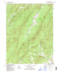
1994 Map of Wolf Gap
USGS Topo · Published 1997About this map
Great North Mountain anchors this mid-1990s look at the border between West Virginia and Virginia, where the ridge and valley landscape dictates both settlement and transport. In the southern reach of the map, the industrial history of the region is evident at Liberty Furnace and Columbia Furnace, centers that once supported the local iron trade. An Old Iron Furnace remains a physical landmark of this era, while an Old Railroad Grade traces a path through the valley near Stony Run.
Find a feature on this map
66 named features on this map. Tap any name to fly to it.
Don’t see what you’re looking for? This feature index may not catch every label — zoom into the map to look around manually.
Map Details
Editions of this 1994 Wolf Gap Map
This is the sole edition of this map. No revisions or reprints were ever made.
Other maps of this area

1891 · Romney
USGS Topo · 1:125,000

1892 · Woodstock
USGS Topo · 1:125,000

1920 · Moorefield
USGS Topo · 1:62,500

1921 · Orkney Springs
USGS Topo · 1:48,000

1921 · Moorefield
USGS Topo · 1:48,000

1922 · Moorefield
USGS Topo · 1:62,500

1922 · Wardensville
USGS Topo · 1:62,500

1923 · Orkney Springs
USGS Topo · 1:62,500

1923 · Edinburg
USGS Topo · 1:62,500

1924 · Wardensville
USGS Topo · 1:62,500