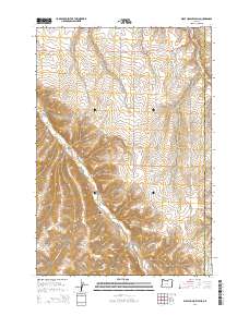
2014 Map of Wolf Hollow Falls
USGS Topo · Published 2014About this map
Flett Cem sits atop the high ground of the Gilliam and Morrow County line, overlooking a landscape defined by deep drainages and cattle country roads. This high-plateau region of Eastern Oregon is cut by significant topographical features such as Cow Canyon and Eightmile Canyon, where the elevation drops sharply into seasonal watercourses. The network of rural routes, including the straight-line path of Baseline Ln and the winding Bunkerhill Rd, follows the natural contours of the land, connecting isolated stock water sources like Irby Reservoir. Small canyons and hollows, such as Waterfalls Hollow and Wolf Hollow, reveal the drainage patterns into Rock Creek, which serves as a primary hydrological artery for the surrounding range. The map illustrates a contemporary rural infrastructure where property boundaries and county lines are as much a part of the landscape as the terrain itself.
Find a feature on this map
23 named features on this map. Tap any name to fly to it.
Don’t see what you’re looking for? This feature index may not catch every label — zoom into the map to look around manually.
Map Details
Editions of this 2014 Wolf Hollow Falls Map
This is the sole edition of this map. No revisions or reprints were ever made.
Other maps of this area

1906 · Blalock Island
USGS Topo · 1:125,000

1908 · Blalock Island
USGS Topo · 1:125,000

1916 · Arlington
USGS Topo · 1:125,000

1916 · Condon
USGS Topo · 1:125,000

1953 · Pendleton
USGS Topo · 1:250,000

1953 · The Dalles
USGS Topo · 1:250,000

1956 · The Dalles
USGS Topo · 1:250,000

1956 · Pendleton
USGS Topo · 1:250,000

1957 · The Dalles
USGS Topo · 1:250,000

1964 · Shutler Flat
USGS Topo · 1:24,000