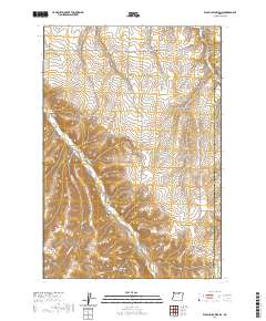
2020 Map of Wolf Hollow Falls
USGS Topo · Published 2020About this map
Wolf Hollow Falls serves as a prominent landmark in this upland drainage system of Gilliam County, where deep canyons and hollows define the landscape. The intricate network of seasonal watercourses includes Eightmile Canyon and Cow Canyon to the north, which channel runoff toward the more substantial Rock Creek drainage in the south. Settlers and land managers in this arid environment carved out routes like Ione Rd and Ridge Rd to navigate the high plateaus between these steep depressions. Local history is anchored at the Flett Cem and the naming of nearby Waterfalls Hollow, suggesting the importance of these specific topographic breaks for early homesteading and livestock management. Small-scale water storage, evidenced by Irby Reservoir, highlights the persistent challenge of water management on the high plains.
Find a feature on this map
28 named features on this map. Tap any name to fly to it.
Don’t see what you’re looking for? This feature index may not catch every label — zoom into the map to look around manually.
Map Details
Editions of this 2020 Wolf Hollow Falls Map
This is the sole edition of this map. No revisions or reprints were ever made.
Other maps of this area

1906 · Blalock Island
USGS Topo · 1:125,000

1908 · Blalock Island
USGS Topo · 1:125,000

1916 · Arlington
USGS Topo · 1:125,000

1916 · Condon
USGS Topo · 1:125,000

1953 · Pendleton
USGS Topo · 1:250,000

1953 · The Dalles
USGS Topo · 1:250,000

1956 · The Dalles
USGS Topo · 1:250,000

1956 · Pendleton
USGS Topo · 1:250,000

1957 · The Dalles
USGS Topo · 1:250,000

1964 · Shutler Flat
USGS Topo · 1:24,000