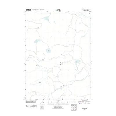
2011 Map of Wolf Lake
USGS Topo · Published 2011About this map
Wolf Lake and its surrounding ranchlands characterize this portion of Cherry County, where the landscape is defined by the drainages of the North Loup River and Gordon Creek. The area is marked by a network of established family ranching operations, including the Becker Ranch, D Phillips Ranch, and Coble Ranch, the latter of which features the Coble Dam and Coble Reservoir. These labels provide a window into the land use and property ownership in Nebraska's Sandhills at the start of the 21st century.
Find a feature on this map
22 named features on this map. Tap any name to fly to it.
Don’t see what you’re looking for? This feature index may not catch every label — zoom into the map to look around manually.
Map Details
Editions of this 2011 Wolf Lake Map
This is the sole edition of this map. No revisions or reprints were ever made.
Other maps of this area

1949 · Steverson Lake
USGS Topo · 1:62,500

1950 · Doughboy
USGS Topo · 1:62,500

1950 · Wolf Lake
USGS Topo · 1:62,500

1951 · Steverson Lake
USGS Topo · 1:62,500

1951 · Wolf Lake
USGS Topo · 1:62,500

1951 · Merriman 4
USGS Topo · 1:62,500

1952 · Doughboy
USGS Topo · 1:62,500

1957 · Valentine
USGS Topo · 1:250,000

1959 · Valentine
USGS Topo · 1:250,000
1985 · Farm Flat
USGS Topo · 1:24,000