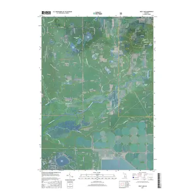
2017 Map of Wolf Lake
USGS Topo · Published 2017About this map
The Muskegon River valley dominates this landscape, winding through a complex system of islands and wetlands including Maple Island and Troque Island. The northern sections are defined by the dense woodlands of the Manistee National Forest, where the Cedar Creek Motorsport Trail snakes through the terrain near several isolated water bodies like Duck Lake and Clear Lake. To the south, the community of Wolf Lake sits near Indian Point, showing the transition from forest to residential settlement.
Find a feature on this map
69 named features on this map. Tap any name to fly to it.
Don’t see what you’re looking for? This feature index may not catch every label — zoom into the map to look around manually.
Map Details
Editions of this 2017 Wolf Lake Map
This is the sole edition of this map. No revisions or reprints were ever made.
Other maps of this area

1930 · Muskegon
USGS Topo · 1:62,500

1936 · Muskegon
USGS Topo · 1:62,500

1945 · Ravenna
USGS Topo · 1:62,500

1954 · Milwaukee
USGS Topo · 1:250,000

1954 · Midland
USGS Topo · 1:250,000

1958 · Midland
USGS Topo · 1:250,000

1958 · Milwaukee
USGS Topo · 1:250,000

1958 · Twin Lake
USGS Topo · 1:62,500

1958 · Fremont
USGS Topo · 1:62,500

1959 · Midland
USGS Topo · 1:250,000
Featured Places
- Wolf Lake, MI
- Egelston Township, MI
- Cedar Creek Township, MI
- Moorland Township, MI
- Bridgeton Township, MI