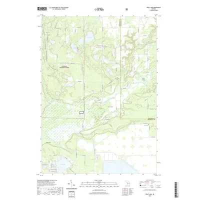
2019 Map of Wolf Lake
USGS Topo · Published 2019About this map
Wolf Lake and its surrounding residential streets anchor the southern edge of this landscape, where the developed community meets the expansive wetlands and wooded tracts of the Manistee National Forest. The northern reach is defined by a dense network of water bodies, including Duck Lake, Muskrat Lake, and Echo Lake, transitioning into the complex riparian system of the Muskegon River. Near the center of the sheet, the settlement of Maple Island sits between the main river channel and the Maple River, surrounded by marshy lowlands. Genealogists will find several burial sites noted, such as Saint Anthonys Cem near the forest boundary and Chidester Cem further east. The area’s varied history is written in its transport patterns, from the remote Otorsport Trail in the northwest to the more formal grid of roads like Maple Island Rd that navigate the river-cut terrain.
Find a feature on this map
92 named features on this map. Tap any name to fly to it.
Don’t see what you’re looking for? This feature index may not catch every label — zoom into the map to look around manually.
Map Details
Editions of this 2019 Wolf Lake Map
This is the sole edition of this map. No revisions or reprints were ever made.
Other maps of this area

1930 · Muskegon
USGS Topo · 1:62,500

1936 · Muskegon
USGS Topo · 1:62,500

1945 · Ravenna
USGS Topo · 1:62,500

1954 · Milwaukee
USGS Topo · 1:250,000

1954 · Midland
USGS Topo · 1:250,000

1958 · Midland
USGS Topo · 1:250,000

1958 · Milwaukee
USGS Topo · 1:250,000

1958 · Twin Lake
USGS Topo · 1:62,500

1958 · Fremont
USGS Topo · 1:62,500

1959 · Midland
USGS Topo · 1:250,000
Featured Places
- Wolf Lake, MI
- Egelston Township, MI
- Cedar Creek Township, MI
- Moorland Township, MI
- Bridgeton Township, MI