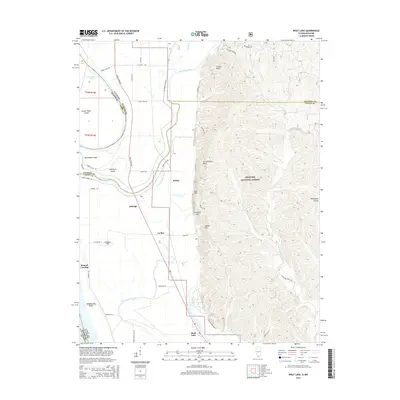
2015 Map of Wolf Lake
USGS Topo · Published 2015About this map
The Big Muddy River winds through the bottomlands of the Mississippi River floodplain, meeting the state boundary between Illinois and Missouri. This modern survey illustrates a landscape of intense water management, defined by an intricate network of levees and drainage projects like Running-Lake Ditch. Small settlements such as Aldridge, La Rue, and Halsey sit along the narrow corridor between the river and the dramatic rising bluffs of the Shawnee National Forest. To the east, the terrain shifts abruptly from the flat agricultural fields of Lambdins Field to the high ridges of the Pine Hills. Notable landmarks such as Preachers Eye and Government Rock overlook the oxbow waters of Wolf Lake, while river features like Tower Island Chute and Hanging Dog Island track the shifting nature of the river's historical course.
Find a feature on this map
57 named features on this map. Tap any name to fly to it.
Don’t see what you’re looking for? This feature index may not catch every label — zoom into the map to look around manually.
Map Details
Editions of this 2015 Wolf Lake Map
This is the sole edition of this map. No revisions or reprints were ever made.
Other maps of this area

1918 · Altenburg
USGS Topo · 1:62,500

1920 · Jonesboro
USGS Topo · 1:62,500

1922 · Cape Girardeau
USGS Topo · 1:62,500

1923 · Jonesboro
USGS Topo · 1:62,500

1924 · Cape Girardeau
USGS Topo · 1:62,500

1924 · Alto Pass
USGS Topo · 1:62,500

1925 · Altenburg
USGS Topo · 1:62,500

1947 · Jonesboro
USGS Topo · 1:62,500

1947 · Alto Pass
USGS Topo · 1:62,500

1947 · Gorham
USGS Topo · 1:24,000