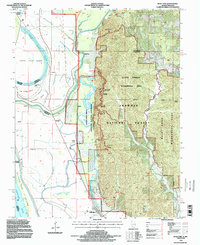
1994 Map of Wolf Lake
USGS Topo · Published 1996About this map
Grand Tower Island and the neighboring Grand Tower riverfront define this stretch of the Mississippi River in the mid-1990s. The landscape is a sharp study in contrasts, where the engineered drainage of the Muddy River bottomlands meets the rising timber of the Shawnee National Forest. The map documents a complex aquatic network of old channels and backwaters, including Wolf Lake, Otter Pond, and the Running Lake Ditch, which manage the frequent overflow of the river system.
Find a feature on this map
53 named features on this map. Tap any name to fly to it.
Don’t see what you’re looking for? This feature index may not catch every label — zoom into the map to look around manually.
Map Details
Editions of this 1994 Wolf Lake Map
This is the sole edition of this map. No revisions or reprints were ever made.
Other maps of this area

1918 · Altenburg
USGS Topo · 1:62,500

1920 · Jonesboro
USGS Topo · 1:62,500

1922 · Cape Girardeau
USGS Topo · 1:62,500

1923 · Jonesboro
USGS Topo · 1:62,500

1924 · Cape Girardeau
USGS Topo · 1:62,500

1924 · Alto Pass
USGS Topo · 1:62,500

1925 · Altenburg
USGS Topo · 1:62,500

1947 · Jonesboro
USGS Topo · 1:62,500

1947 · Alto Pass
USGS Topo · 1:62,500

1947 · Gorham
USGS Topo · 1:24,000