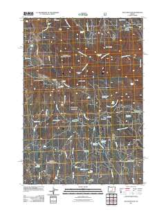
2011 Map of Wolf Mountain
USGS Topo · Published 2011About this map
Wolf Mountain and the high ridges of Grant County define this landscape, where the headwaters of numerous creeks begin their descent through the terrain. The central summit is flanked by the West Wolf Lookout and East Wolf Lookout, overseeing a network of forest roads like Wolf Mountain Rd and Hardscrabble Rd. This area is characterized by an extensive system of high-altitude water management, featuring a dense concentration of small catchments including Blue Jay Reservoir, Robin Reservoir, and Battle Ridge Reservoir.
Find a feature on this map
58 named features on this map. Tap any name to fly to it.
Don’t see what you’re looking for? This feature index may not catch every label — zoom into the map to look around manually.
Map Details
Editions of this 2011 Wolf Mountain Map
This is the sole edition of this map. No revisions or reprints were ever made.
Other maps of this area

1932 · Dayville
USGS Topo · 1:125,000

1936 · Dayville
USGS Topo · 1:125,000

1955 · Canyon City
USGS Topo · 1:250,000

1959 · Canyon City
USGS Topo · 1:250,000

1966 · Antone
USGS Topo · 1:24,000

1966 · Six Corners
USGS Topo · 1:24,000

1972 · Wolf Mountain
USGS Topo · 1:24,000

1972 · Day Basin
USGS Topo · 1:24,000
1972 · Aldrich Gulch
USGS Topo · 1:24,000
1972 · Dayville
USGS Topo · 1:24,000