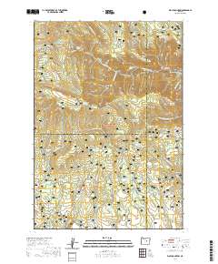
2020 Map of Wolf Mountain
USGS Topo · Published 2020About this map
Ochoco National Forest spans this 2020 study at the intersection of Wheeler, Grant, and Crook counties. The terrain is defined by a series of prominent ridges and basins, including Battle Ridge, Princess Ridge, and the Honeymoon Basin. Water management is a central theme of the landscape, evidenced by numerous named storage features such as Kelsey Reservoir, South Prong Reservoir, and Congleton Cr Reservoir. These improvements support the high-country ranching and forestry operations that have long characterized this part of the Blue Mountains.
Find a feature on this map
63 named features on this map. Tap any name to fly to it.
Don’t see what you’re looking for? This feature index may not catch every label — zoom into the map to look around manually.
Map Details
Editions of this 2020 Wolf Mountain Map
This is the sole edition of this map. No revisions or reprints were ever made.
Other maps of this area

1932 · Dayville
USGS Topo · 1:125,000

1936 · Dayville
USGS Topo · 1:125,000

1955 · Canyon City
USGS Topo · 1:250,000

1959 · Canyon City
USGS Topo · 1:250,000

1966 · Antone
USGS Topo · 1:24,000

1966 · Six Corners
USGS Topo · 1:24,000

1972 · Wolf Mountain
USGS Topo · 1:24,000

1972 · Day Basin
USGS Topo · 1:24,000
1972 · Aldrich Gulch
USGS Topo · 1:24,000
1972 · Dayville
USGS Topo · 1:24,000