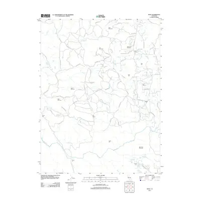
2012 Map of Wolf
USGS Topo · Published 2012About this map
The Bear River flows along the southern reach of this Nevada County landscape, defining a terrain of prominent peaks and intricate water management systems. The community of Wolf sits in the eastern hills, surrounded by landmarks like Sugar Loaf Mountain and Pine Hill. To the south, Garden Bar and Cranston Ranch mark the lower elevations near the riverbanks. The map documents an extensive network of water infrastructure, including the Cole Ditch, Redinger Ditch, and Wolf Ditch, which underscore the historical importance of water rights and irrigation in this part of the California foothills. Local social centers such as the Banner Grange are recorded alongside family-named summits like Cole Hill and Lucas Hill, providing valuable geographic context for those researching regional settlement patterns and land use in the early twenty-first century.
Find a feature on this map
70 named features on this map. Tap any name to fly to it.
Don’t see what you’re looking for? This feature index may not catch every label — zoom into the map to look around manually.
Map Details
Editions of this 2012 Wolf Map
This is the sole edition of this map. No revisions or reprints were ever made.
Other maps of this area

1888 · Smartsville
USGS Topo · 1:125,000

1891 · Sacramento
USGS Topo · 1:125,000

1891 · Smartsville
USGS Topo · 1:125,000

1892 · Sacramento
USGS Topo · 1:125,000

1892 · Smartsville
USGS Topo · 1:125,000

1893 · Sacramento
USGS Topo · 1:125,000

1894 · Smartsville
USGS Topo · 1:125,000

1895 · Smartsville
USGS Topo · 1:125,000

1910 · Lincoln
USGS Topo · 1:31,680

1915 · Spenceville
USGS Topo · 1:31,680