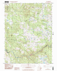
1998 Map of Wolf
USGS Topo · Published 2002About this map
The Bear River defines the southern reaches of this landscape, marking the boundary between Nevada and Placer counties. Near the river, the settlement of Garden Bar sits at the foot of Bald Rock Mountain, while the Hannaman Trail and Emigrant Road provide a look at the historical movement through the foothills. Further north, the settlement of Wolf and the Pine Hill Mine indicate the area's agricultural and mineral heritage.
Find a feature on this map
32 named features on this map. Tap any name to fly to it.
Don’t see what you’re looking for? This feature index may not catch every label — zoom into the map to look around manually.
Map Details
Editions of this 1998 Wolf Map
This is the sole edition of this map. No revisions or reprints were ever made.
Other maps of this area

1888 · Smartsville
USGS Topo · 1:125,000

1891 · Sacramento
USGS Topo · 1:125,000

1891 · Smartsville
USGS Topo · 1:125,000

1892 · Sacramento
USGS Topo · 1:125,000

1892 · Smartsville
USGS Topo · 1:125,000

1893 · Sacramento
USGS Topo · 1:125,000

1894 · Smartsville
USGS Topo · 1:125,000

1895 · Smartsville
USGS Topo · 1:125,000

1910 · Lincoln
USGS Topo · 1:31,680

1915 · Spenceville
USGS Topo · 1:31,680