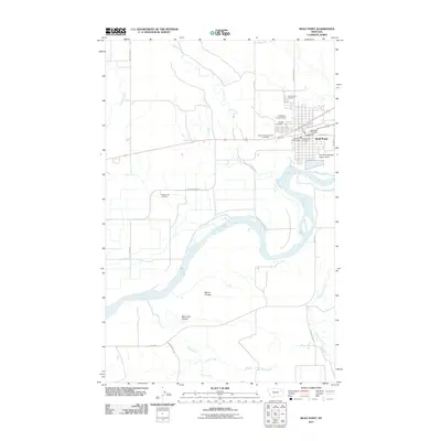
2011 Map of Wolf Point
USGS Topo · Published 2011About this map
The Missouri River curves through this landscape, defining the southern boundary of Wolf Point in Roosevelt County. As a hub of local activity and government, the settlement contains the Wolf Point Post Office, Wolf Point Vol Fire Dept, and the Roosevelt Co Fire Dept. The town's infrastructure extends to the Wolf Point Sewage Lagoon Dam along the riverbanks.
Find a feature on this map
31 named features on this map. Tap any name to fly to it.
Don’t see what you’re looking for? This feature index may not catch every label — zoom into the map to look around manually.
Map Details
Editions of this 2011 Wolf Point Map
This is the sole edition of this map. No revisions or reprints were ever made.
Other maps of this area

1915 · Oswego
USGS Topo · 1:62,500

1916 · Wolf Point
USGS Topo · 1:62,500

1954 · Glendive
USGS Topo · 1:250,000

1954 · Wolf Point
USGS Topo · 1:250,000

1957 · Glendive
USGS Topo · 1:250,000

1958 · Wolf Point
USGS Topo · 1:250,000

1958 · Glendive
USGS Topo · 1:250,000

1972 · Flynn Creek North
USGS Topo · 1:24,000

1972 · Wolf Point
USGS Topo · 1:24,000

1972 · Macon
USGS Topo · 1:24,000
Featured Places
- Wolf Point District, MT
- Wolf Point, Wolf Point District
- Roosevelt County, MT
- McCone County, MT
- United States