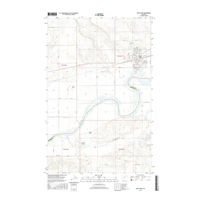
2017 Map of Wolf Point
USGS Topo · Published 2017About this map
Wolf Point serves as the primary hub of this landscape, situated at a bend in the Missouri River where the BNSF Railway parallels the river's northern bank. The town's grid is meticulously detailed, extending from Front St near the tracks to residential avenues named for early local families and regional history. Several legacy sites offer significant genealogical value, including Greenwood Cem and Kings Cem near the town center, while the more remote Chicken Hill Cem is located to the southwest.
Find a feature on this map
67 named features on this map. Tap any name to fly to it.
Don’t see what you’re looking for? This feature index may not catch every label — zoom into the map to look around manually.
Map Details
Editions of this 2017 Wolf Point Map
This is the sole edition of this map. No revisions or reprints were ever made.
Other maps of this area

1915 · Oswego
USGS Topo · 1:62,500

1916 · Wolf Point
USGS Topo · 1:62,500

1954 · Glendive
USGS Topo · 1:250,000

1954 · Wolf Point
USGS Topo · 1:250,000

1957 · Glendive
USGS Topo · 1:250,000

1958 · Wolf Point
USGS Topo · 1:250,000

1958 · Glendive
USGS Topo · 1:250,000

1972 · Flynn Creek North
USGS Topo · 1:24,000

1972 · Wolf Point
USGS Topo · 1:24,000

1972 · Macon
USGS Topo · 1:24,000
Featured Places
- Wolf Point District, MT
- Wolf Point, Wolf Point District
- Roosevelt County, MT
- McCone County, MT
- United States