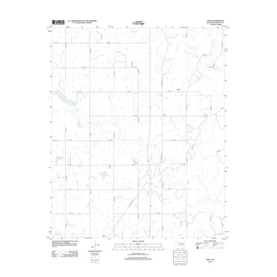
2012 Map of Wolf
USGS Topo · Published 2012About this map
The community of Wolf anchors this portion of Seminole County, situated north of the Little River and surrounded by a network of drainage-control reservoirs. The landscape is defined by the tributaries of Salt Cr, where the Soil Conservation Service infrastructure is prominent through features like Salt Cr Site 42 Reservoir and Salt Cr Site 49 Reservoir. These water management sites illustrate the mid-to-late 20th-century transformation of the Oklahoma countryside to manage erosion and flooding in the river basin.
Find a feature on this map
39 named features on this map. Tap any name to fly to it.
Don’t see what you’re looking for? This feature index may not catch every label — zoom into the map to look around manually.
Map Details
Editions of this 2012 Wolf Map
This is the sole edition of this map. No revisions or reprints were ever made.
Other maps of this area

1896 · Seminole and Prague
USGS Topo · 1:125,000

1901 · Stonewall
USGS Topo · 1:125,000

1907 · Maud
USGS Topo · 1:62,500

1908 · Maud
USGS Topo · 1:62,500

1954 · Oklahoma City
USGS Topo · 1:250,000

1957 · Ardmore
USGS Topo · 1:250,000

1957 · Oklahoma City
USGS Topo · 1:250,000

1958 · Sasakwa
USGS Topo · 1:24,000

1958 · Vamoosa
USGS Topo · 1:24,000

1958 · Konawa
USGS Topo · 1:24,000