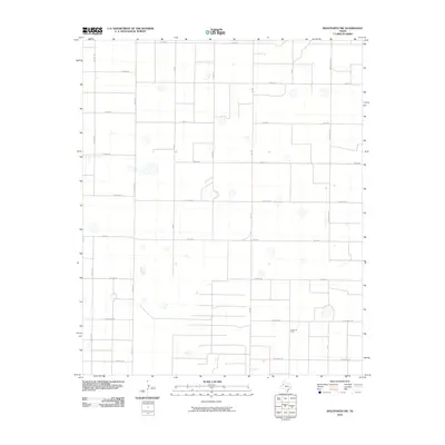
2010 Map of Wolfforth NW
USGS Topo · Published 2010About this map
Smyer Oil Field anchors the southeastern portion of this Hockley County landscape, illustrating the industrial footprint typical of the Llano Estacado. The map reveals a highly structured grid of rural roads, including Fm 1294 and Fm 168, which segment the terrain into precise agricultural and resource parcels. Named local thoroughfares like Fisher Rd, El Paso Rd, and Onion Shed Rd provide evidence of the regional transit network connecting scattered farmsteads and petroleum sites. The presence of numerous small, isolated depressions across the quadrangle suggests the natural playa lake features characteristic of the High Plains, interspersed among a naming convention for roads that draws from American states, such as Kansas Rd, Iowa Rd, and Georgia Rd.
Find a feature on this map
19 named features on this map. Tap any name to fly to it.
Don’t see what you’re looking for? This feature index may not catch every label — zoom into the map to look around manually.
Map Details
Editions of this 2010 Wolfforth NW Map
This is the sole edition of this map. No revisions or reprints were ever made.
Other maps of this area

1954 · Brownfield
USGS Topo · 1:250,000

1957 · Anton
USGS Topo · 1:62,500

1957 · Wolfforth
USGS Topo · 1:62,500

1958 · Brownfield
USGS Topo · 1:250,000

1962 · Brownfield
USGS Topo · 1:250,000

1964 · Lums Chapel
USGS Topo · 1:24,000

1964 · Whitharral
USGS Topo · 1:24,000

1965 · Levelland East
USGS Topo · 1:24,000
1976 · Anton SW
USGS Topo · 1:24,000
1976 · Wolfforth NW
USGS Topo · 1:24,000