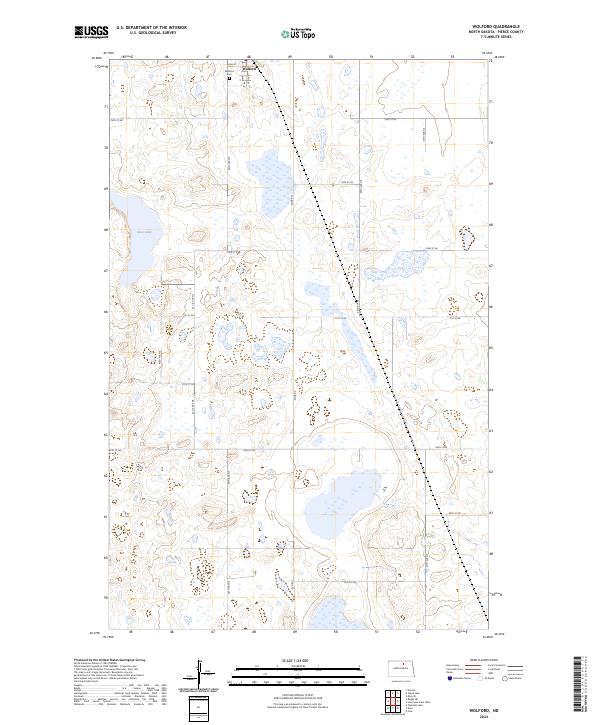
2024 Map of Wolford
USGS Topo · Published 2024About this map
Wolford stands as the primary settlement on this northern North Dakota prairie, characterized by a structured grid of rural roads and expansive conservation lands. The landscape is defined by the Pierce County Waterfowl Production Area, which spans large sections of the quadrangle to protect the region's vital prairie pothole wetlands. These natural depressions, including Guss Lake, are essential stops for migratory birds and reflect the glacial history of the Drift Prairie. For genealogists and local historians, the Wolford Cem located just outside the town site provides a specific point of interest for family research. The infrastructure remains rooted in agriculture and transit, with Knox Rd and a network of numbered section-line roads like 44th Ave NE connecting isolated farmsteads across the township boundaries of t158n r70w and t157n r70w.
Find a feature on this map
22 named features on this map. Tap any name to fly to it.
Don’t see what you’re looking for? This feature index may not catch every label — zoom into the map to look around manually.
Map Details
Editions of this 2024 Wolford Map
This is the sole edition of this map. No revisions or reprints were ever made.
Other maps of this area

1953 · Devils Lake
USGS Topo · 1:250,000

1956 · Devils Lake
USGS Topo · 1:250,000

1971 · Wolford
USGS Topo · 1:24,000

1971 · Island Lake
USGS Topo · 1:24,000

1971 · Knox
USGS Topo · 1:24,000

1971 · Rugby NE
USGS Topo · 1:24,000

1971 · Hurricane Lake West
USGS Topo · 1:24,000

1971 · York
USGS Topo · 1:24,000

1971 · Mylo SE
USGS Topo · 1:24,000
1971 · Pleasant Lake
USGS Topo · 1:24,000