
1971 Map of Wolford
USGS Topo · Published 1973About this map
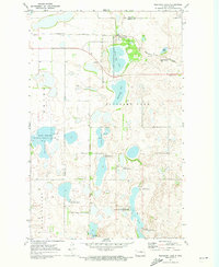
Wolford stands at the northern edge of this 1971 survey, serving as a hub for the surrounding agricultural prairie of Pierce County. The landscape is defined by its glacial prairie potholes and drainage patterns, most notably the expansive Rush Lake and the smaller, distinct Guss Lake. The Burlington Northern railroad cuts a diagonal path across the terrain, a vital transport link for the region's grain economy. This era shows a rural landscape where section lines and field boundaries, visible through aerial photography from the late 1960s, dictate the local geography. Several Gravel Pits are scattered near the rail line and water bodies, indicating the importance of local material extraction for road building and infrastructure in this part of North Dakota.
Find a feature on this map
7 named features on this map. Tap any name to fly to it.
Don’t see what you’re looking for? This feature index may not catch every label — zoom into the map to look around manually.
Map Details
Editions of this 1971 Wolford Map
This is the sole edition of this map. No revisions or reprints were ever made.
Other maps of this area

1953 · Devils Lake
USGS Topo · 1:250,000

1956 · Devils Lake
USGS Topo · 1:250,000

1971 · Island Lake
USGS Topo · 1:24,000

1971 · Knox
USGS Topo · 1:24,000

1971 · Rugby NE
USGS Topo · 1:24,000

1971 · Hurricane Lake West
USGS Topo · 1:24,000

1971 · York
USGS Topo · 1:24,000

1971 · Mylo SE
USGS Topo · 1:24,000
1971 · Pleasant Lake
USGS Topo · 1:24,000
1971 · Nanson
USGS Topo · 1:24,000